
Water Gap
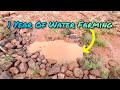
A water gap is a small, permeable structure built in ephemeral or intermittent drainages, gullies, or swales to capture sediment and nutrients. It acts as a barrier that slows water flow, allowing suspended materials to settle out, thereby preventing valuable topsoil and nutrients from being lost downstream while recharging local groundwater. These structures are adaptable, ranging from simple rock dams to more complex buried log or weave-wire designs, depending on local materials and site conditions.
Read More: Complete Description
Water gaps are essential structures for farms and ranches looking to retain soil, moisture, and nutrients on their land, directly supporting regenerative agriculture principles. They are designed to intercept runoff in draws, gullies, or swales, which are natural drainage pathways that can become sources of erosion and nutrient loss. By strategically placing these barriers, land managers can dramatically slow down water flow, allowing sediment and dissolved nutrients to be deposited behind the structure. This process not only prevents soil loss but also augments soil organic matter and fertility in the area where the water gap is located.
The fundamental mechanism of a water gap is to reduce the velocity of surface runoff. In natural drainages, water can accelerate rapidly, picking up loose soil particles and carrying dissolved nutrients (like nitrogen and phosphorus) with it. By introducing a permeable obstruction, the water's speed is reduced, causing it to drop its load of sediment. This sediment is essentially fertile topsoil. The water that passes through the gap is cleaner, and the deposition behind the gap effectively builds more productive soil over time.
From a regenerative agriculture perspective, water gaps are foundational practices that reinforce multiple principles. Primarily, they address Keeping Soil Covered (Principle 3) by creating conditions where soil is less likely to be eroded away. By trapping sediment and moisture, they foster the growth of vegetation, further stabilizing the soil and keeping it covered. They also indirectly support Minimizing Soil Disturbance (Principle 1) by preventing the physical removal of topsoil, thereby preserving the soil structure that natural biological processes are working to build.
Furthermore, water gaps significantly enhance Maintaining Living Roots (Principle 4) by increasing soil moisture availability. The captured water percolates into the soil profile, replenishing groundwater and making more moisture accessible to plant roots for a longer period, especially during dry spells. This extended moisture availability allows perennial forages, trees, or cover crops to remain photosynthetically active for more of the year, supporting continuous soil cover and biological activity. The increased soil organic matter resulting from sediment deposition also feeds soil biology, indirectly supporting the entire soil food web.
Water gaps also play a role in Integrating Livestock (Principle 5) and Maximizing Crop Diversity (Principle 2). In grazing systems, water gaps help keep animals in paddocks longer by extending the forage growing season through improved moisture retention, reducing the need for supplemental feed and concentrating manure where it's beneficial. In diverse cropping systems, they can help establish riparian buffers or hedgerows along drainages by creating a more favorable moisture environment for a wider range of plant species.
The design of a water gap is context-dependent and should prioritize permeability to avoid creating dam-like structures that can lead to waterlogging upstream or sudden releases downstream. Permeability allows water to pass through gradually, promoting infiltration and reducing the risk of catastrophic failure. Materials can range from locally sourced rocks, sandbags, straw bales, to buried logs, woven wire with vegetation, or even specialized gabion structures. The key is engineering a structure that slows water and traps sediment without impeding necessary drainage.
Unlike a complete dam or culvert, a water gap is designed to be porous, allowing water to seep through. This permeability is crucial for preventing upstream flooding and ensuring that water is absorbed into the soil rather than pooling excessively. The effectiveness of a water gap is enhanced when vegetation is encouraged to establish both behind and in front of it. This vegetation, stabilized by the structure, further binds soil, slows water, and increases infiltration.
The construction of water gaps can be a low-cost, high-impact intervention. They are particularly effective in arid, semi-arid, and Mediterranean climates where water conservation is paramount and erosion can be severe. However, their application extends to humid regions as well, where they help manage excess runoff, prevent nutrient leaching, and replenish groundwater tables. International examples include "check dams" in India, "swale systems" in Australia, and "water harvesting structures" used across African drylands, all serving similar functions of water and sediment retention.
The maintenance of water gaps is typically minimal but essential. Periodic checks to ensure permeability and remove accumulated sediment that might block flow are necessary. If vegetation establishment is poor, seeding or transplanting native grasses and shrubs can enhance functionality. Over time, the accumulated sediment can form fertile soil terraces that can be incorporated into production systems or left as a stable, vegetated buffer.
Sources behind this view
Key Points
What It Is
- Permeable structure in drainages
- Captures sediment and nutrients
- Slows water, promotes infiltration
- Built with local materials (rocks, logs, etc.)
Why Do It
- Prevents soil erosion and nutrient loss
- Builds fertility and soil organic matter
- Increases local soil moisture
- Recharges groundwater table
Know the Debate
- Effectiveness varies by climate: arid regions excel, humid needs careful design.
- Costs range from <$200 (DIY rock) to $10k+ (large gabions).
- Labor is significant; material choice impacts cost and scale.
- Vegetation establishment is key to long-term success.
Benefits - Financial
- Increases annual dry-land forage yield by 15–30% in drainage zones.
- Reduces annual synthetic fertilizer input expenses by 10–15% via sedimentation.
- Boosts overall land valuation by 5–10% through permanent soil stabilization.
Benefits - System
- Captures >70% of sediment in runoff
- Enhances soil organic matter: 0.5-1.5% increase
- Supports Principle 3 (Keep Soil Covered)
- Supports Principle 4 (Maintain Living Roots)
Risks - Financial
- Initial installation ranges from $315 to $15,650 based on scale.
- Potential 100% loss of investment if structural anchoring fails immediately.
- Annual maintenance requirement of 2–5% of original capital expenditure.
Risks - System
- Blocked flow causing upstream waterlogging
- Ineffective if not permeable enough
- May concentrate surface water flow downstream if poorly designed

How These Traits Are Calculated
Trait dimensions are ordered clockwise starting from the top of the chart (12 o'clock position):
1. Economic Potential
Financial returns, annual value, and break-even timeline
WHAT: Evaluates financial viability by combining net annual value ($/ha from savings, income, and amortized harvests) with break-even timeline showing when practices pay for themselves.
WHY: Farmers need clear ROI understanding before committing resources. Fast payback (≤3 years) with strong returns (≥$300/ha) enables confident adoption, while long timelines (>10 years) restrict adoption to well-funded operations willing to wait for returns.
HOW: Calculated from net annual value in $/ha and break-even years. Exceptional (≥2.6): fast ROI ≤3 years + high value ≥$300/ha. Typical (1.8-2.5): moderate returns or longer timelines. Limited (<1.8): marginal economics or very long payback >10 years.
2. Startup Affordability
Initial investment costs and financial barrier to entry
WHAT: Measures financial barrier to entry through startup costs for equipment, infrastructure, consulting, and materials. Inverted scoring: lower costs = higher scores = more accessible adoption.
WHY: Affordability determines who can adopt. Low-cost practices (<$250/ha) enable widespread adoption across diverse scales, while high costs (>$2,500/ha) limit adoption to well-capitalized operations, creating barriers that slow regenerative transition.
HOW: Calculated from initial investment parsed from practice content. Inverted scoring: Exceptional (≥2.6): minimal investment <$250/ha. Typical (1.8-2.5): moderate costs $250-2,500/ha. Limited (<1.8): high barrier >$2,500/ha.
3. Implementation Ease
Learning curve and specialized knowledge required
WHAT: Measures how much learning, planning, and specialized knowledge a practice requires. Simpler practices with fewer steps score higher, while complex practices requiring extensive training or specialized resources score lower.
WHY: Complex practices create adoption barriers even when economically viable. Straightforward practices enable faster adoption and broader participation, while those requiring extensive training, timing precision, or specialized equipment limit who can succeed.
HOW: Evaluated by measuring documentation length and identifying complexity markers like location-specific requirements, seasonal timing windows, specialized skills, and dedicated equipment needs. Exceptional (≥2.6): straightforward practices with minimal prerequisites. Typical (1.8-2.5): moderate learning curve with some specialized needs. Limited (<1.8): steep learning curve requiring significant training or resources.
4. Risk Mitigation
Identified financial and ecological risk assessment
WHAT: Evaluates documented risks across financial (investment loss, market volatility) and ecological (crop failure, pest outbreaks) domains. Inverted scoring: fewer risks = higher scores.
WHY: Understanding risk exposure helps farmers make informed decisions. Low-risk practices allow confident implementation, while high-risk practices require careful planning and contingency resources. Risk transparency prevents costly failures.
HOW: Calculated from identified risks in practice content. Inverted scoring: Exceptional (≥2.6): ≤2 risks with manageable severity. Typical (1.8-2.5): 3-5 moderate risks. Limited (<1.8): 6+ risks or severe exposure.
5. System Benefits
How many ways the practice improves your land simultaneously
WHAT: Measures how many aspects of land health improve at once—carbon storage, soil quality, erosion control, water absorption, and biodiversity. Practices that improve multiple areas simultaneously create compounding benefits where each improvement reinforces the others.
WHY: The best practices solve multiple problems at once. For example, addressing erosion simultaneously builds carbon and improves water infiltration, creating a resilient system with positive feedback loops. Single-benefit approaches miss these compound transformation opportunities.
HOW: Evaluated across five key outcomes: carbon sequestration, soil organic matter increase, erosion reduction, water infiltration improvement, and biodiversity enhancement. Exceptional (≥2.6): high carbon storage (>8 t/ha/yr), improvements across 4-5 areas, transformative outcomes. Typical (1.8-2.5): moderate carbon (3-8 t/ha/yr), improvements across 2-3 areas. Limited (<1.8): modest impact (<3 t/ha/yr), single-area focus only.
6. Climate Adaptability
Geographic applicability across Köppen climate zones
WHAT: Evaluates geographic applicability by assessing how many Köppen climate zones successfully support a practice and what adaptation requirements are needed. Measures breadth of climates where farmers can implement with minimal to moderate modifications.
WHY: Universal practices working across diverse climates enable more farmers to adopt regenerative approaches. Practices limited to single climate types (only Mediterranean, only tropical) restrict adoption and slow global transition. Adaptability determines whether a practice serves niche regions or offers broad transformation.
HOW: LLM evaluation of regional success stories, Köppen zone coverage, and adaptation needs. Exceptional (≥2.6): 5+ zones or 4+ climate types, 3+ continents, minimal adaptation. Typical (1.8-2.5): 3-4 zones or 2-3 types, 2 continents, moderate adaptation. Limited (<1.8): 1-2 zones, single region, significant adaptation or highly specialized.
7. Integration Fit
How well this practice combines with others you're doing
WHAT: Measures how well a practice combines with other regenerative practices you might be doing. Some practices work as building blocks that make many other practices easier or more effective, while others work best on their own.
WHY: Practices that combine well with many others create more value on your farm. For example, cover cropping enables no-till, improves grazing, supports crop diversity, and helps water management—making all of them work better together. This helps you build a coherent system rather than juggling disconnected practices.
HOW: Evaluated by identifying which practices combine well and how strong those combinations are. 'Ideally Suited' means strong combinations where practices reinforce each other (practice A makes B easier, while B makes A more effective). 'Adequate' means complementary benefits that work well together. Exceptional (≥2.6): combines well with 6+ practices, serves as a building block. Typical (1.8-2.5): combines with 3-5 practices. Limited (<1.8): 1-2 practices or works best alone.
Going Deeper
1
WHY - The Benefits
Water gaps are versatile structures that deliver significant benefits for soil health, water management, and overall farm resilience, integrating seamlessly into regenerative land management systems. Their impact reverberates from individual field micro-sites to broader...
Water gaps are versatile structures that deliver significant benefits for soil health, water management, and overall farm resilience, integrating seamlessly into regenerative land management systems. Their impact reverberates from individual field micro-sites to broader...
Soil Health Benefits
Water gaps act as sediment traps, capturing nutrient-rich topsoil that would otherwise be lost to downstream erosion. Over time, this accumulated sediment mixes with decomposing plant matter, increasing SOM levels by an average of 0.5–1.5% in the deposition zone — improving aggregation, water infiltration, and nutrient cycling.
By slowing runoff velocity and dissipating the energy of moving water, water gaps prevent soil particle detachment and transport. The deposition zone also encourages perennial vegetation establishment, further stabilizing the soil.
The permeable nature of water gaps allows water to seep slowly into the soil profile, extending moisture availability for adjacent vegetation. This supports deeper root growth, enhanced microbial activity, and can reduce irrigation needs. For a fuller treatment of water-harvesting earthworks and their soil health benefits, see swales.
Economic Benefits
The economic advantages of water gaps stem from reduced input costs and increased productivity. By trapping nutrient-rich sediment, they continuously fertilize the surrounding soil, reducing the need for synthetic fertilizers. Farmers in arid and semi-arid regions report savings of 15–25% on irrigation costs where water gaps effectively retain moisture for longer periods.
In grazing operations, the enhanced forage growth due to increased soil moisture and fertility can boost perennial pasture yields by 20–30%, particularly in dryland systems. This improved forage availability supports higher stocking rates and better animal performance, leading to increased livestock revenue. Reduced erosion also means fewer costs associated with repairing gully damage and managing sedimentation in farm infrastructure like ponds or irrigation ditches.
Sources behind this view
-
How does building healthy soils impact sustainable use of water resources in irrigated agriculture? (opens in new window)
This study found: Improving soil health in irrigated agriculture can increase water availability, enhance plant water use efficiency, and build drought resilience, reducing reliance on irrigation water.
-
Agriculture Insights for Improving the Soil Conservation through Optimizing of Water Storage and Advanced Agricultural Methods (opens in new window)
This study found: Improving soil health through organic matter is key for water conservation and crop yields. Effective water management, including using groundwater and constructed wetlands, is crucial for soil protec
2
WHERE - Regional Considerations
Water gaps are adaptable to a wide range of climates and landscapes, but their design and effectiveness are influenced by regional factors such as rainfall patterns, soil types, and the availability of construction materials.
Water gaps are adaptable to a wide range of climates and landscapes, but their design and effectiveness are influenced by regional factors such as rainfall patterns, soil types, and the availability of construction materials.
Click Here to Look up your Region if you don't already know it
Arid and Semi-Arid Regions
Representative Locations: Western United States, North Africa, Central Asia, Interior Australia, parts of the Sahelian region in Africa
Climate Context: Low annual precipitation (<40 cm or 15 inches), high temperatures, short and often unpredictable growing season. USDA Zones 7-9, Köppen BSh/BSk.
Suitability: Excellent. These regions are characterized by high erosion risk due to sparse vegetation and intense rainfall events. Water gaps are a primary tool for water harvesting, sediment capture, and combating desertification. They trap scarce rainfall, promoting vegetation establishment in otherwise barren areas and recharging shallow aquifers. Materials like rocks, brush, and gabions are often readily available. The "water harvesting" effect can significantly extend the grazing season.
Mediterranean Regions
Representative Locations: California, Mediterranean basin (Spain, Italy, Greece), central Chile, southwestern Australia, Western Cape South Africa
Climate Context: Hot, dry summers and mild, wet winters. Annual precipitation 40-90 cm (15-35 inches), highly seasonal. USDA Zones 8-10, Köppen Csa/Csb.
Suitability: High. These regions experience intense winter rains and prolonged summer droughts, leading to significant erosion potential. Water gaps effectively capture winter rainfall and runoff, increasing soil moisture for perennial forages and trees during the dry summer months. They help mitigate summer drought stress on pastures and reduce sediment loads in streams during peak storm events. Native vegetation establishment behind gaps is highly effective and can be enhanced with local seeds.
Humid Temperate Regions
Representative Locations: Southeastern United States, northern Europe (UK, Germany, Poland), eastern China, Japan, New Zealand
Climate Context: Warm to hot summers and cool to cold winters with moderate to high annual precipitation (75-150 cm or 30-60 inches) distributed relatively evenly. USDA Zones 6-8, Köppen Cfb/Cfa.
Suitability: Moderate to High. While erosion may be less severe than in arid regions due to consistent vegetation cover, water gaps are still valuable for managing runoff, preventing gully formation in pastures, and improving water infiltration. They help retain soil and nutrients on slopes, preventing their loss into tile drainage systems or surface water. They can be particularly useful in livestock management to keep animals from over-grazing or compacting sensitive riparian areas. Construction materials like rock and brush are abundant.
Subtropical Regions
Representative Locations: Southeastern USA, Southern China, Southern Brazil, Eastern Australia
Climate Context: Hot, humid summers and mild winters with generally ample rainfall. USDA Zones 9-11, Köppen Cfa/Cwa.
Suitability: Moderate. Similar to humid temperate regions, water gaps help manage runoff and prevent gully erosion, especially on susceptible soils. They can also aid in replenishing shallow groundwater, which is beneficial during periods of higher evapotranspiration. The abundant vegetation in these areas can quickly stabilize water gaps, enhancing their performance and reducing the need for frequent maintenance.
Tropical Regions
Representative Locations: Central America, Southeast Asia, East Africa, Northern Australia, Northern South America
Climate Context: High temperatures year-round, with distinct wet and dry seasons or consistent high rainfall. Köppen Af/Am/Aw.
Suitability: Moderate to High. In regions with distinct wet and dry seasons, water gaps are critical for capturing precious rainy-season water and preventing erosion during intense downpours. They help maintain soil moisture into the dry season, supporting perennial vegetation. In consistently high-rainfall areas, they manage runoff to prevent gully formation and nutrient leaching, particularly on steep terrain common in some tropical agricultural areas. Construction using locally sourced materials like brush, rocks, and bamboo is often highly effective.
Cold Continental Regions
Representative Locations: Northern USA and Canada, Northern Europe, Northern Asia
Climate Context: Very short growing seasons, extreme summer heat, severe winter cold. USDA Zones 3-5, Köppen Dfa/Dfb.
Suitability: Moderate. Water gaps can be effective in these regions, but timing of construction and consideration of freeze-thaw cycles are critical. They primarily help manage spring snowmelt runoff and intense summer thunderstorms, preventing soil loss. Vegetation establishment might be limited to the short growing season, requiring careful species selection and potentially seeding. Permeability is crucial to prevent ice damage during winter.
3
HOW - Implementation Process
HOW - Implementation Process
Before constructing a water gap, consider these crucial prerequisites:
- Site Assessment: Identify ephemeral drainages, gullies, or swales prone to erosion. Assess slope, soil type, and expected water flow volume and velocity.
- Material Availability: Determine what natural or salvaged materials are readily available on-site or nearby (rocks, logs, brush, sandbags, old tires, gabion wire).
- Purpose: Clarify the primary goal—sediment capture, water harvesting, gully stabilization, or a combination.
- Downstream Impact: Ensure the structure will not cause undue waterlogging upstream or concentrated, damaging flow downstream. Permeability is key.
- Local Regulations: Check with local agricultural extension, land management agencies, or environmental bodies for any permits or guidelines regarding watercourse modifications.
Phase 1: Design and Material Selection
-
Determine Structure Type and Size:
- Small gullies/swales: Simple brush dams, rock loosestrife, or woven wire with vegetation can be effective. Aim for a structure that creates a slight ponding area without significant upstream flooding.
- Larger drainages: Rock gabions, buried log structures, or robust woven wire might be necessary. Consider the watershed area contributing flow to estimate peak runoff.
- Permeability Test: Visualize or test the permeability of your chosen material. It should allow water to pass through gradually, not hold it back entirely like a dam.
-
Material Gathering/Preparation:
- Rocks: Collect clean, angular rocks of various sizes. Avoid smooth, rounded river rocks that don't interlock well.
- Logs/Brush: Use durable, rot-resistant wood if possible. Brush bundles should be tightly packed.
- Wire: Galvanized woven wire mesh (e.g., 2x4 inch or 4x6 inch openings) is durable. Gabions require wire cages filled with rocks.
- Geotextile Fabric: Consider using a permeable geotextile fabric behind wire or rock structures to prevent soil fines from washing through while allowing water to pass.
Phase 2: Construction
-
Excavation (if needed): For more robust structures, excavate a shallow keyway on the sides and bottom to anchor the structure and prevent undercutting. Embed the base of the structure into the stable soil sides of the gully.
-
Building the Barrier:
- Rock/Gabion Gaps: Place larger rocks to form the base and sides, interlocking them. Fill the core with smaller rocks and gravel. For gabions, fill wire cages with rocks. Ensure a slight slope towards the center for drainage if desired.
- Brush/Log Dams: Layer logs or thick brush bundles perpendicular to the flow direction. Pack additional brush tightly between logs to form a dense, yet permeable barrier. Bury the base logs into the gully bed and sides.
- Woven Wire Structures: Install sturdy posts on the gully sides and bottom. Stretch wire mesh across the opening, securing it to posts. Backfill with brush, rocks, or soil to increase density and sediment trapping capacity.
-
Incorporating Permeability:
- Rock/Gabion: Leave intentional voids between rocks or use larger-sized rocks appropriately.
- Brush/Log: Ensure bundles are not excessively compacted; some water should be able to seep through.
- Wire: Use appropriate mesh size and backfill with materials that allow drainage.
- Add an "Outlet": For larger structures, consider incorporating a drainage pipe or a specifically designed permeable zone in the center to ensure controlled water release.
-
Anchoring and Stabilization: Ensure the structure is well-anchored on the sides of the drainage to prevent water from channeling around it. Use native soil or rocks to backfill and stabilize the edges.
Phase 3: Vegetation Establishment
-
Seeding/Planting: Once the structure is in place, seed or plant the area behind and slightly in front of it with native, water-loving, erosion-resistant species. This is crucial for long-term stabilization and increased effectiveness. Consider grasses like fescues, bromes, or native sedges depending on your region.
-
Mulching: Apply a layer of straw or woodchip mulch to help retain moisture, suppress weeds, and protect the soil while new vegetation establishes.
-
Protection: If livestock are present, temporarily fence off the area behind the water gap to protect young vegetation from grazing until it is well-established (typically 6-12 months).
Phase 4: Monitoring and Maintenance
-
Initial Observation: Monitor the water gap after the first significant rainfall event. Check for structural integrity, signs of undercutting, and water flow through the structure.
-
Periodic Checks: Conduct checks seasonally or after major storm events. Remove accumulated sediment if it impedes water flow or is becoming too deep. Clear any blockages.
-
Vegetation Management: Ensure established vegetation remains healthy. Reseed or replant if necessary. Prune or manage invasive species if they outcompete desirable plants.
-
Structural Repairs: Address any damage promptly, especially to anchoring points or the main barrier material.
4
Know the Debate
Water gap effectiveness and design depend heavily on your specific environment. In arid rangelands, they are critical for moisture harvesting and s...
Know the Debate
Water gap effectiveness and design depend heavily on your specific environment. In arid rangelands, they are critical for moisture harvesting and s...
Water gap effectiveness and design depend heavily on your specific environment. In arid rangelands, they are critical for moisture harvesting and soil building, transforming barren areas. In humid climates, they manage excess runoff and prevent gully erosion. Construction costs can range from under $200 for simple rock dams using local materials and DIY labor to over $10,000 for large structures requiring hired crews and specialized materials. Regardless of scale, successful establishment of vegetation is crucial for long-term stability and function.
How effectively do water gaps work in different climates?
Highly effective in arid/semi-arid climates (water harvesting)
Academic studies and field practitioners highlight the exceptional impact of water gaps in arid and semi-arid regions. Here, they are crucial for capturing scarce rainfall, significantly extending moisture availability, and enabling vegetation establishment on otherwise dry land. Their role in combating desertification and recharging groundwater is well-documented.
Sources behind this view
Sources behind this view
-
Demonstrates the function of swales and check dams during heavy rain in Arizona, showing how they capture, slow, and infiltrate water, with the speaker manually building check dams to manage runoff and collect sediment.
-
In arid areas, stock ponds mimicking beaver dams are used to manage erosion gullies by slowing and spreading runoff, creating perennial water flow and restoring riparian zones, with potential integration with gated pipe systems.

-
Rainwater Harvesting and Sustainable Agriculture in Arid Lands: Runoff Farming in the Area of Wadi al-Bab (opens in new window)
This study found: In dry regions where water is scarce, a traditional farming method called runoff farming has been used for thousands of years. It involves collecting rainwater that flows down hills and through dry riverbeds (Wadis). Farmers build small stone walls (check dams) and dig trenches and ditches to slow the water down, allowing it to soak into the ground or be channeled to irrigate nearby fields. Some of this collected water is also stored in underground tanks. This technique helps make farming possible and sustainable in arid areas, as seen in the Wadi al-Bab region.
-
Impact of soil depth and topography on the effectiveness of conservation practices on discharge and soil loss in the Ethiopian Highlands (opens in new window)
This study found: A three-year study in the Ethiopian Highlands compared how well soil and water conservation measures worked in two different areas. One area had deep soil and gentle slopes, while the other had shallow soil and steep slopes. After installing practices like bunds, waterways, and infiltration furrows, both areas saw a small decrease in direct water runoff. However, the area with deep soil also saw an increase in water flowing slowly over time, suggesting better water retention. Crucially, the amount of soil lost with the water dropped significantly: by 81% in the deep soil area and 45% in the shallow soil area. This shows that deep soils are much better at storing water and making conservation practices more effective at reducing erosion and improving water availability.
Moderate effectiveness in humid/temperate climates (runoff/gully control)
In regions with more reliable rainfall, water gaps serve primarily to manage excess runoff, prevent gully erosion, and trap nutrients. While still beneficial for soil stability, their primary role shifts from water harvesting to controlled drainage and sediment capture. Success depends on permeable design to avoid waterlogging.
Sources behind this view
Sources behind this view
-
Effects of Intra-Storm Soil Moisture and Runoff Characteristics on Ephemeral Gully Development: Evidence from a No-Till Field Study (opens in new window)
This study found: Researchers studied how small, temporary ditches (ephemeral gullies) form and grow in a no-till farm field in Kansas over two years. They tracked rainfall, soil wetness, and water flow during storms. By measuring the force of the water and how wet the soil was, they found that the amount of water in the soil during a storm significantly impacts how much erosion occurs. They developed a way to better predict this erosion by including these intra-storm soil moisture changes, which is crucial for preventing soil loss and sedimentation in waterways.
-
The Relationship between Erosion and Precipitation and the Effects of Different Riparian Practices on Soil and Total-P Losses via Streambank Erosion in Small Streams in Iowa, USA (opens in new window)
This study found: A seven-year study in Iowa looked at how different ways of managing land along streams affected soil erosion and phosphorus loss. They found that heavy rainfall, especially in spring and summer, was the main cause of stream bank erosion. Practices like planting trees or grass strips along rivers, and using fenced pastures for livestock, kept significantly more soil in place and reduced phosphorus runoff compared to intensive grazing or planting row crops right up to the stream. Row crops had the worst soil loss. The study shows that keeping natural vegetation along waterways is crucial for protecting soil and water quality, but this protection can be challenged by changing weather patterns.
-
Methods to reduce soil loss include cover crops for soil structure and erosion prevention, grass waterways for concentrated flow, water and sediment control basins to stop flow, and grade stabilization structures to halt gully erosion.
-
Practical methods to reduce soil loss include planting cover crops for longer soil cover and improved structure, establishing grass waterways for concentrated flow, installing water and sediment control basins, and using grade stabilization structures to prevent gully erosion.
Context-dependent success based on soil type and design
The key to effectiveness in any climate is appropriate design for local soil conditions and water flow. Heavily relying on structures without considering subsoil permeability or slope can lead to waterlogging in wet areas or failure in dry areas. Proper siting and material choice are crucial.
Sources behind this view
Sources behind this view
-
Greg Judy details building a water gap with swinging metal roofing sections attached to fiberglass posts, allowing flood debris to pass while maintaining animal containment across creeks.

-
Recommends raising culvert inlets to meadow surface elevation to prevent drainage and headcut erosion, and removing impediments like abandoned roads and ditches that disrupt natural water flow and wetland function.
-
Impact of soil depth and topography on the effectiveness of conservation practices on discharge and soil loss in the Ethiopian Highlands (opens in new window)
This study found: A three-year study in the Ethiopian Highlands compared how well soil and water conservation measures worked in two different areas. One area had deep soil and gentle slopes, while the other had shallow soil and steep slopes. After installing practices like bunds, waterways, and infiltration furrows, both areas saw a small decrease in direct water runoff. However, the area with deep soil also saw an increase in water flowing slowly over time, suggesting better water retention. Crucially, the amount of soil lost with the water dropped significantly: by 81% in the deep soil area and 45% in the shallow soil area. This shows that deep soils are much better at storing water and making conservation practices more effective at reducing erosion and improving water availability.
Making Sense of the Differences
Water gap effectiveness is strongly tied to climatic conditions and water management goals. Arid regions benefit most from their water-harvesting capacity, while humid regions utilize them more for runoff control and gully prevention. Success in any climate hinges on matching design to local soil permeability, rainfall intensity, expected water flow, and available vegetation for stabilization. Farmers should select designs that prioritize permeability to avoid waterlogging in wet areas or failure in dry ones.
What are the costs and labor requirements for building water gaps?
Low-cost, high-labor (DIY with local materials)
Small water gaps constructed using on-site rocks, logs, or brush can be very low-cost ($100-$350 per structure) and primarily labor-intensive for DIY farmers. This approach leverages natural resources and minimizes capital outlay.
Sources behind this view
Sources behind this view
-
Greg Judy details building a water gap with swinging metal roofing sections attached to fiberglass posts, allowing flood debris to pass while maintaining animal containment across creeks.
-
Learn practical, human-scale water management techniques like 'water bars' and 'silt traps' to slow, spread, and sink water, preventing erosion and retaining soil. Use observation to guide incremental shovel work, creating S-curves in the landscape and enhancing soil fertility.
-
Chicken wire can be used to secure smaller rocks for gully dams. A regenerative approach emphasizes slowing upstream water via grazing management (rest, hay rolling) and promoting plant cover for infiltration to prevent gully growth.
-
Gully control uses check dams (stones, brushwood, hedges) built incrementally (0.3m/yr) to reduce runoff velocity, promote deposition, and enable water harvesting and cultivation.
Moderate cost, moderate labor (mixed materials/hired help)
Medium-sized water gaps may require a mix of on-site and purchased materials like woven wire or gabion cages, with some hired labor for heavy lifting or difficult terrain. Costs can range from $500 to $3,800 per structure.
Sources behind this view
Sources behind this view
-
Describes implementing log and rock check dams and pipe crossings in seasonal waterways to mitigate erosion, retain water, and trap sediment, creating landscape 'sponges' that recharge the ground and extend water availability.
-
Guidance on pond and dam construction, spillway design, sediment trapping, and site selection, emphasizing stable slopes, vegetation, aquifer recharge, and minimizing erosion and sediment disturbance.
-
Provides practical guidance on water gap fencing, recommending materials like polywire, high-tensile wire, barn tin, galvanized pipes, and treated wood, considering water flow, debris, and soil stability for effective livestock containment.
-
Provides detailed instructions for water gap fencing, including post and wire placement, filling materials, and adapting to variable water levels. Recommends electric fencing with current limiters and emphasizes regular maintenance.
High cost, high capital/labor (large scale/engineered)
Large-scale structures or those requiring engineering for significant flow and erosion control can cost $3,000 to over $15,000. These often involve purchased materials, heavy machinery, and significant hired labor or custom work.
Sources behind this view
Sources behind this view
-
An erosion control project uses water retention basins (dams) with trickle pipes to slow water and trap sediment in gullies, complemented by revegetation and rock-lined channels, with designs by the NSW Soil Conservation Service.
-
Design of a grassed waterway (20ft bottom, 8:1 slopes, 50-60 cfs capacity) in Ashland County, WI, to prevent field gullies. Explores future low-tech process-based restoration (log structures, woody debris) in upstream ravines to slow flows.
-
Rock weirs and flumes are effective for preventing gully formation and erosion by slowing concentrated water flow. Proper construction involves appropriate rock size (6-18 inches depending on water volume), correct shaping to direct water over and through the structure, and sufficient rock quantity. These are permanent solutions for waterway stabilization.
-
Details the construction of a 1900-foot waterway in Hardin County, Iowa, to control soil erosion and protect water quality, highlighting the role of NRCS cost-share programs in supporting land stewardship.
Making Sense of the Differences
The financial and labor investment for water gaps varies greatly. Small, DIY structures using on-site materials typically cost $100-$350. Medium structures with mixed materials and some hired labor can range from $500-$3,800. Large-scale, engineered solutions can exceed $3,000 upwards to $15,000+. Farmers should prioritize using local resources and consider seeking government cost-share programs to mitigate initial expenses, carefully assessing their labor capacity and the scale of erosion they need to address.
5
HOW MUCH - Costs & Investment
Note: Costs shown in USD; multiply by local labor and material cost indices for your region. Labor costs vary significantly internationally.
Note: Costs shown in USD; multiply by local labor and material cost indices for your region. Labor costs vary significantly internationally.
Note: All costs are based on recent US economic data (2024–2026) and may vary substantially by region based on local labor rates, material costs, and regulatory requirements.
Material Procurement Costs
The scale of a water gap structure dictates the complexity of the material supply chain. For small-scale operations under 50 acres (20 ha), the focus is on utilizing onsite natural resources, such as loose rock, downed timber, and brush. In these setups, cash expenditures range from $315 to $730, primarily covering secondary materials like earth staples, galvanized tension wire, and untreated hemp fiber rolls to hold brush in place.
Mid-size operations (50–500 acres (20–202 ha)) typically require material with higher structural integrity to manage increased hydrological load. Costs shift to $2,600–$4,700, covering purchased gabion baskets, heavy-duty 11-gauge wire mesh, and geotextile filter fabrics necessary to prevent sub-surface erosion. Large-scale installations (500+ acres) necessitate high-durability components to mitigate the risk of catastrophic failure during high-intensity rain events. Procuring industrial-grade riprap (engineered angular stone), core-locking logs, and high-tensile anchor steel brings material costs to $8,350–$15,650 per structure. Producers must also account for site-specific fencing materials, with steel pipe or treated wood posts for livestock exclusion zones adding $210–$1,050 to the procurement budget depending on the length of the protected drainage area.
Labor and Equipment Installation
Labor remains the primary variable in the total cost profile for water gap implementation. For small-scale DIY projects, the majority of the investment is calculated as labor opportunity cost; however, if hiring local contract labor for land preparation and manual rock placement, operators should budget $160–$625 for a standard 1-day build. These costs account for manual trenching and site clearing.
Mid-size projects require professional-grade mechanical assistance to move heavy aggregate and perform keying-in, which prevents water from "piping" beneath the structure. Hiring an excavator or skid steer operator often ranges from $835 to $3,130 for the time required to site, level, and armor the spillway. For large-scale projects, which often impact significant intermittent stream channels, professional consultation and heavy machinery hire are mandatory. Expect expenditures of $3,130–$12,500 for installation equipment and professional labor. This assumes 40 to 80 man-hours of skilled labor to ensure the structure is anchored deep into the gully walls and that the overflow zone is correctly armored with geotextile lining.
Site Engineering and Regulatory Costs
Agricultural land improvements involving drainages are subject to varying levels of oversight depending on the local jurisdiction and the potential impact on downstream water flow. Small-scale projects on private, exempted agricultural land generally incur minimal to no professional regulatory costs. Mid-size producers often reach a threshold where professional consultation becomes necessary to manage energy dissipation; planning and site design from a local NRCS specialist or private consultant can range from $520 to $1,565 to ensure overflow capacity meets regional hydrologic standards.
Large-scale operations involving significant intermittent or perennial drainages often trigger state or federal environmental review processes. These assessments, which ensure that new structures do not violate downstream water rights or floodplain management regulations, require professional surveying and engineering stamped documentation. These compliance costs range from $2,600 to $8,350. This upfront investment is critical, as failing to secure proper engineering sign-off on major landscape-modifying water structures can lead to mandatory removal or costly post-construction fines.
Most Spend: The majority of agricultural operations (the middle 60%) fall into these cost brackets: Small ($450–$600), Medium ($3,200–$4,100), and Large ($10,500–$13,500). These figures represent the most common scenarios where producers balance the use of free, onsite natural materials with essential professional equipment rental for critical tasks like trenching and spillway armoring.
Why the Range?: The primary drivers of cost variation are the proportion of "found" materials relative to "imported" materials and the level of mechanical intervention required by the local topography. In areas with high rock availability and stable soil types (clay-dominant), costs trend toward the bottom of the range, whereas in sandy, high-velocity drainage environments that demand extensive geotextile fabric and engineered riprap, costs inevitably climb toward the upper thresholds.
6
REWARDS AND RISKS - Economics & Risk Factors
REWARDS AND RISKS - Economics & Risk Factors
Economic Scenarios In a Best Case Scenario, the operation successfully stalls runoff, capturing 80% of suspended sediment on-site. Within 3 growing seasons, soil moisture retention improves, leading to a 30% increase in marginal forage production in the drainage zone. Total ROI is realized within 4 years through $420–$1,250 in annual fertilizer savings, reduced water pumping requirements, and improved cattle weight gains on higher-quality grazing.
In a Typical Case Scenario, the farmer invests $3,500 into a medium-scale structure, achieving a 60% reduction in sediment loss and a 16–20% increase in forage yield in the immediate vicinity. The payback period is 6–8 years, supported by a 5% increase in total land valuation recognized by lenders due to stable stream bank improvements.
In a Worst Case Scenario, improper anchoring or failure to key the structure into the banks leads to a "blowout" during a major 5-year storm event. The owner absorbs a total loss of the $3,000–$5,500 investment, and emergency re-stabilization and remediation efforts increase total project expenditure by an additional $2,100–$4,200. No productive gain is realized, and the structure becomes a navigational hazard for machinery and livestock, necessitating a complete site overhaul.
Market Factors and Risk Mitigation Profitability is significantly influenced by government cost-share programs, specifically the USDA EQIP program, which can offset 50–75% of installation costs if the practice meets specific Soil Health and Water Quality criteria. Producers must perform professional soil and hydrologic analysis before construction to provide data-backed ROI estimates for these applications. Risk mitigation is essentially an exercise in spillway protection; installing a "failsafe" armored overflow section adds 10–15% to material costs but reduces long-term repair liability by an estimated 40%. Annual inspection of anchor tensioning is mandatory, with a recommended budget of 2–5% of the original installation cost earmarked specifically for periodic re-tightening of wires and debris removal.
Transition Period Risks While constructing water gaps creates "hard" infrastructure rather than biological shifts, there is a distinct risk of short-term pasture degradation during the construction phase. Heavy machinery can induce localized compaction in a 15-foot (4.6 m) radius around the construction site, potentially depressing forage yield by 10% in that zone for the first 12–18 months. To manage this, construction is strictly confined to the dormant season when soil moisture levels are lower and compaction risk is minimized. In instances where the structure significantly alters natural drainage patterns, there is a risk of temporary vegetation die-off in the downstream zone caused by altered water availability. Producers should budget $150–$500 to re-seed these affected areas with deep-rooted native grasses within 30 days of project completion, ensuring soil stability while the new hydrologic regime establishes itself.
7
COMPATIBLE PRACTICES - Integration Opportunities
Water gaps are highly synergistic with a range of regenerative agriculture practices, amplifying their benefits and contributing to a more resilient and productive landscape.
Water gaps are highly synergistic with a range of regenerative agriculture practices, amplifying their benefits and contributing to a more resilient and productive landscape.
Contour Farming/Plowing
- Building water gaps along the contour lines of fields further enhances water retention and reduces erosion.
- Integration Benefit: Contour lines slow water flow, and water gaps act as focal points for infiltration and deposition along these slowing contours, creating micro-terraces.
Swales and Berms
- Water gaps can be integrated into swale systems or act as mini-swales themselves in smaller drainages. They help to slow and spread water along contour lines.
- Integration Benefit: Creates a distributed water management system across the landscape, improving infiltration and supporting diverse vegetation.
Rotational Grazing / Adaptive Multi-Paddock Grazing
- Water gaps can be strategically placed within paddocks to manage water sources and slow runoff, improving pasture resilience and extending grazing periods.
- Integration Benefit: Better moisture distribution supports healthier, more productive pastures that can withstand grazing pressure, reducing soil disturbance and enhancing nutrient cycling.
Cover Cropping
- Seeding cover crops above and below water gaps helps stabilize the structures, build soil organic matter, and prevent erosion.
- Integration Benefit: Living roots of cover crops reinforce the water gap structure, increase water infiltration, and contribute to the fertility of the trapped sediment.
Silvopasture and Agroforestry
- Planting trees or shrubs above and around water gaps adds structural diversity and further stabilizes soil.
- Integration Benefit: Tree roots enhance soil structure and water holding capacity, while leaf litter contributes to organic matter behind the gap. They create stable riparian zones.
Rock Lined Channels / Check Dams
- Water gaps can be part of a larger erosion control strategy using rock Lined channels or multiple check dams in series.
- Integration Benefit: Larger systems manage more significant water flows and erosion, with individual water gaps serving as building blocks or focal points within the system.
Wetland Restoration / Riparian Zone Management
- Water gaps are instrumental in slowing runoff and promoting infiltration, which is key to restoring degraded riparian zones or creating small wetland areas.
- Integration Benefit: Improves water quality, creates habitat for wildlife, and enhances biodiversity by retaining moisture and sediment in sensitive areas.
The integration of water gaps with these practices creates a cascade of benefits. By managing water flow and retaining soil, they lay the foundation for improved soil health, increased plant growth, and greater ecological resilience across the landscape. They are a low-tech, high-impact tool that empowers land managers to work with natural water cycles rather than against them.
Sources behind this view
-
Learn practical, human-scale water management techniques like 'water bars' and 'silt traps' to slow, spread, and sink water, preventing erosion and retaining soil. Use observation to guide incremental
-
Discusses how integrated water systems (ponds, swales, greywater) mimic natural sponges (beavers, forests) to increase stream flow, recharge aquifers, and support ecosystems like salmon. This approach

-
Nature-based solutions using natural structures like contour banks and check dams can halt erosion, increase water infiltration, and improve landscape resilience by slowing water, promoting infiltrati

-
Provides practical strategies for water management: improving access through drainage, creating ponds with minimal impact, and enhancing ephemeral pools for habitat using straw bale dams and riparian
Read more (opens in new window) permies.com